
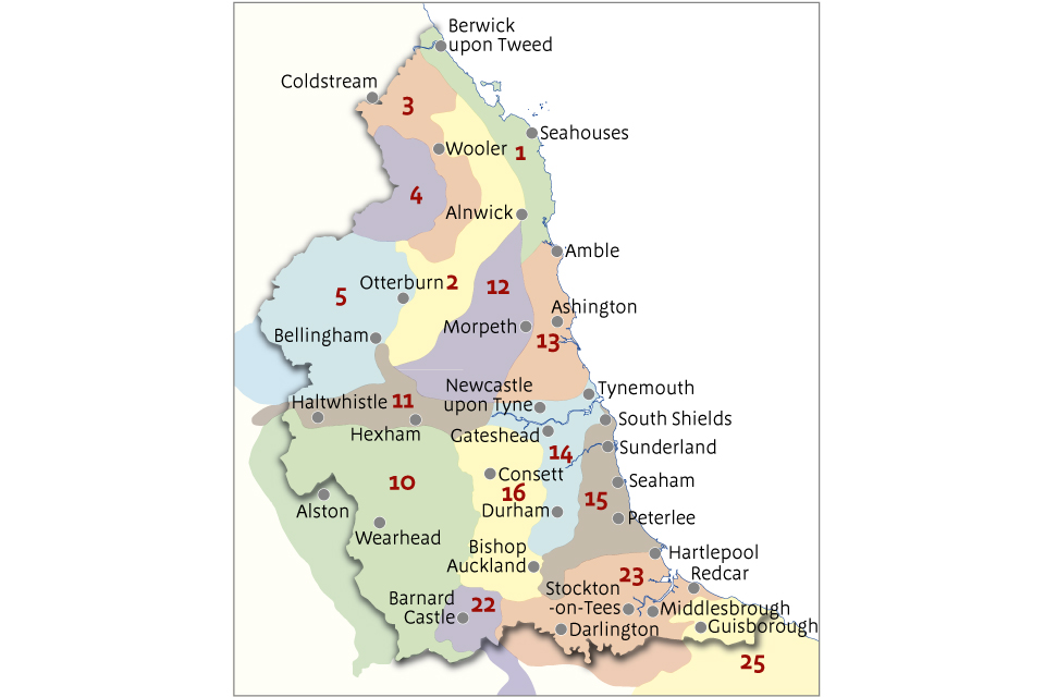
Northumberland’s landscape is full of dramatic contrasts — uplands, coastlines, valleys, and rolling farmland. I wanted to capture that character in a tactile, educational way, so I set out to carve a topographical map of Northumberland, broken down into its official National Character Areas (NCAs). Each NCA would become its own puzzle piece, carved in relief using my CNC router.
Gathering the Topographical Data
I began by sourcing accurate elevation data for Northumberland using publicly available digital terrain models. After trimming the data to the county boundary, I overlaid the National Character Area boundaries and exported each NCA as a clean vector outline. These outlines would become the puzzle pieces, and the terrain model would become the 3D relief.
Building the 3D Model in Vectric Aspire
Importing the Terrain Model
I imported the heightmap into Aspire as a 3D component and scaled the Z-height to create a natural but visually striking relief.
Preparing the NCA Boundaries
Each NCA outline was imported as a vector. Aspire’s vector tools allowed me to clean edges, smooth curves, and ensure each boundary was watertight so the pieces would interlock perfectly.
Splitting the Terrain Into Puzzle Pieces
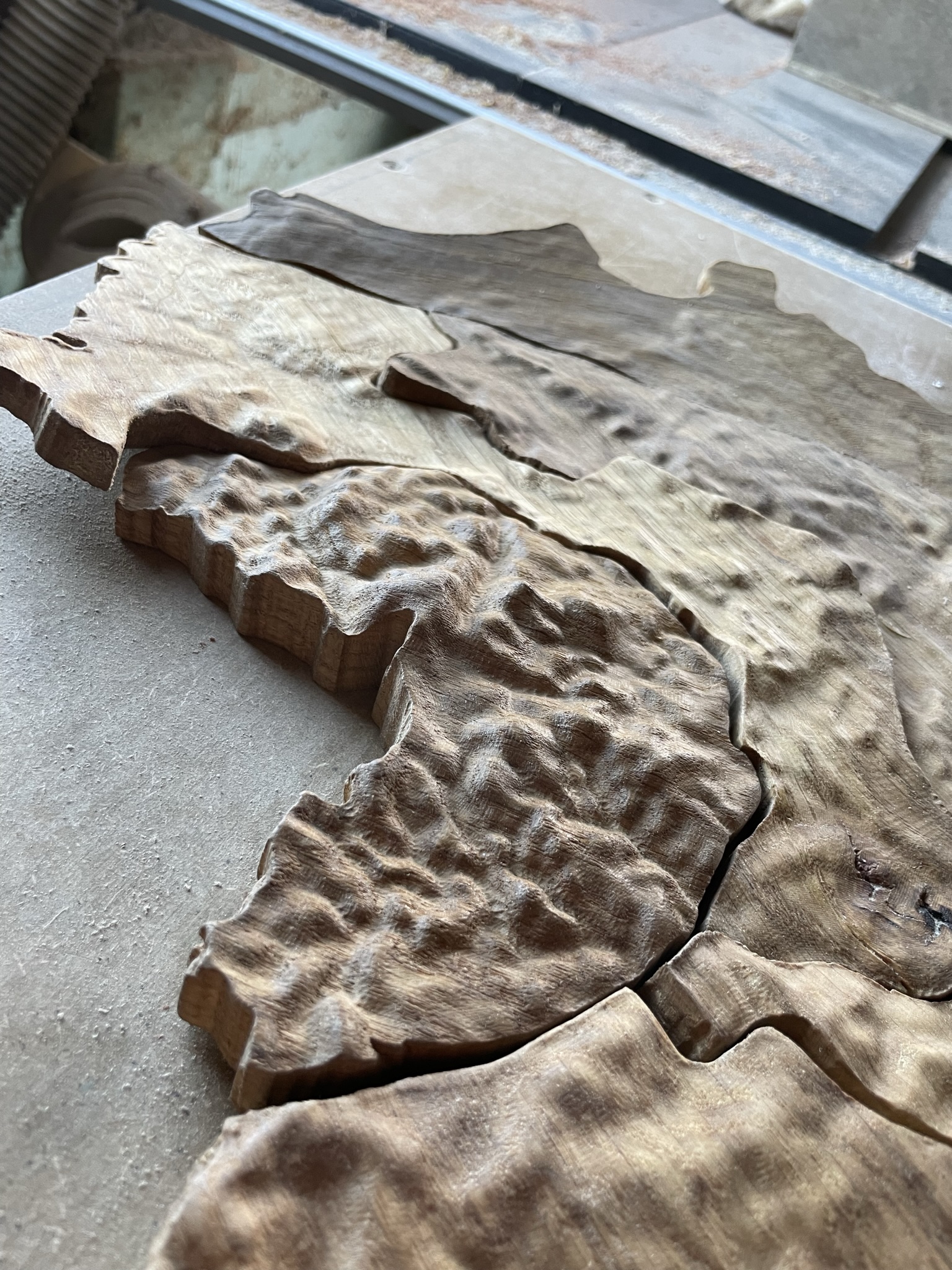
Using Aspire’s Split Component Using Vectors tool, I sliced the 3D terrain model into separate components — one for each NCA. Each region now had its own 3D topography and clean edges ready for machining.
Adding Fit Tolerances
To make the pieces behave like a real jigsaw, I added slight bevels, a small clearance allowance, and a consistent base depth. This ensured the pieces would drop into place smoothly without visible gaps.
Toolpathing the Project
With the digital model complete, I generated the toolpaths:
- Roughing pass with an end mill to remove bulk material
- Finishing pass with a ball‑nose bit to capture terrain detail
- Profile cuts to separate each NCA piece
Aspire’s preview tools were essential for checking every pass before machining.
CNC Carving: Bringing the Landscape to Life
On the CNC, the terrain emerged layer by layer — the Cheviots, the sandstone ridges, the coastal plain, and the deep valleys. After machining, I removed tabs, sanded edges, and applied a finish that highlighted both the wood grain and the relief.
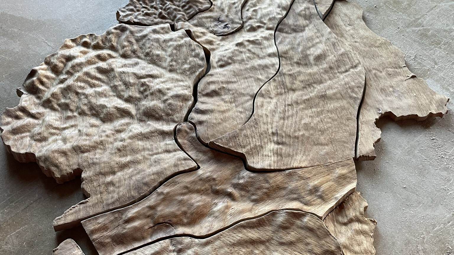
The Final Jigsaw
The finished map assembles beautifully. Each National Character Area fits snugly into its neighbours, forming a tactile, three‑dimensional representation of Northumberland’s landscape. It’s a piece that celebrates the county’s geography — carved in wood, shaped by data, and brought to life through CNC craftsmanship.